Wednesday, October 22, 2014
Tuesday, October 14, 2014
Watershed Environmental Education
Terry’s Creek passes by Rising Sun Montessori School in
Floyd, VA. Students first learned about the watershed by looking at maps and
discussing what the term “watershed” means. We then hit the road to walk and
explore the watershed, seeing the actual terrain we saw on the maps. We learned
about how water flows underground and seeps out of the ground, how water falls
as precipitation and flows downhill into surface waters, and how wetlands are
important to clean and provide areas for flooding. Although we didn’t see the
very beginning of the stream, we came close! We also got to see areas that had
recently been logged and talked about how that affects how clean the water is
and how it affects the “bugs” in the stream.
Labeled Geographic Field Trip Overview Blue Lines Showing Terry's Creek and Smaller Tributaries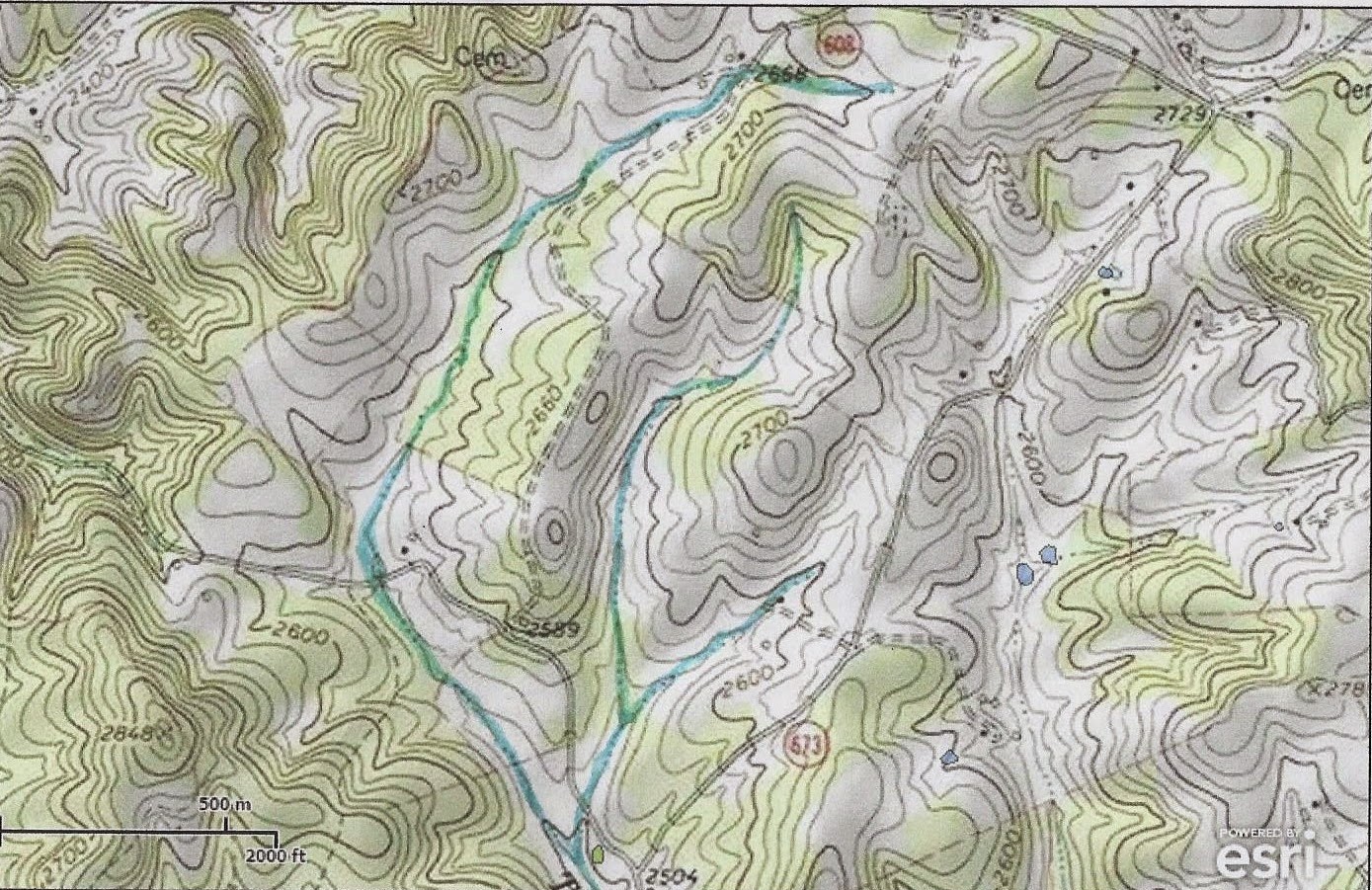 Pictures of Our Watershed Experience!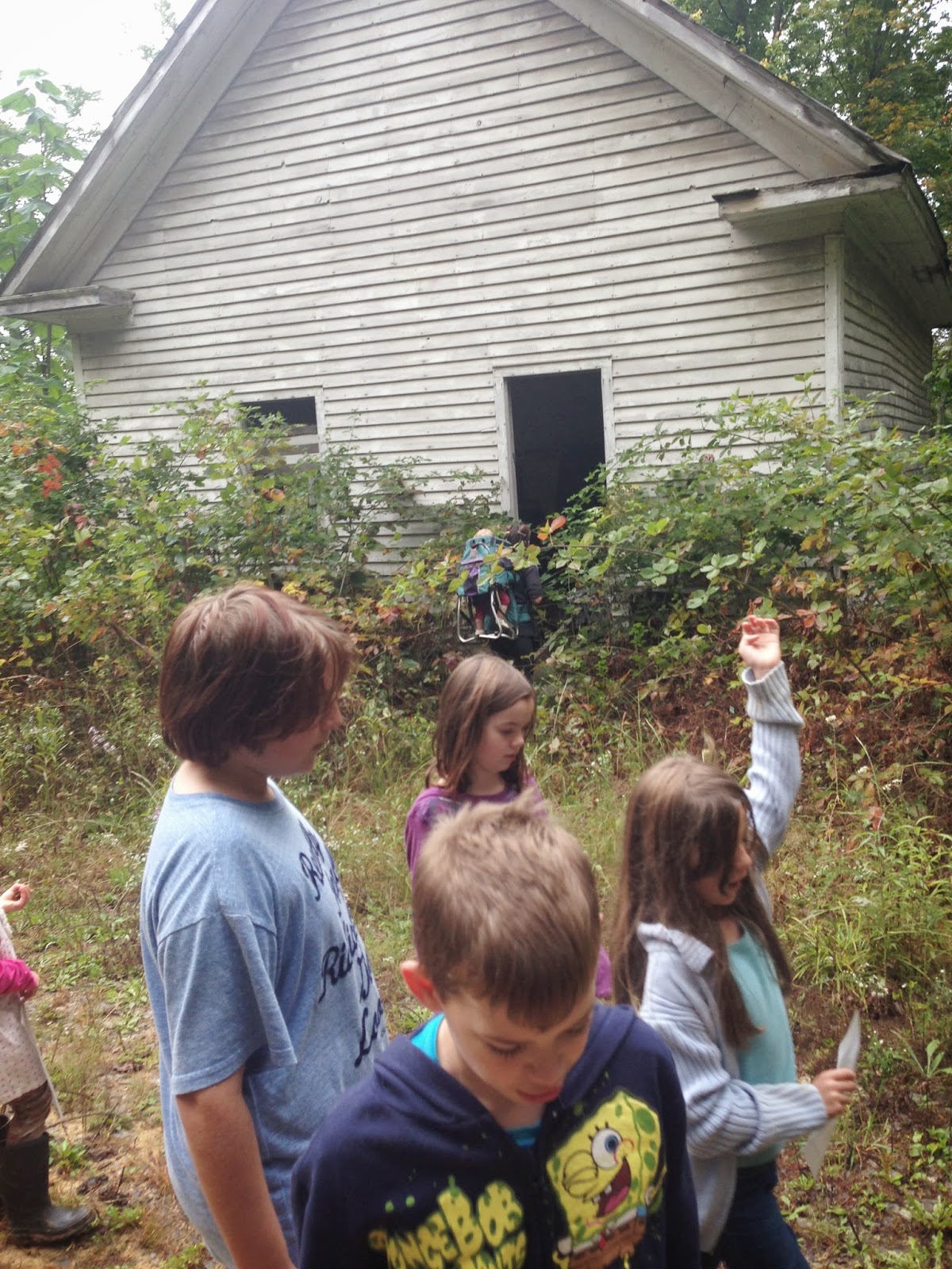 |
| We learned history too! It's the first African American school in Floyd County. |
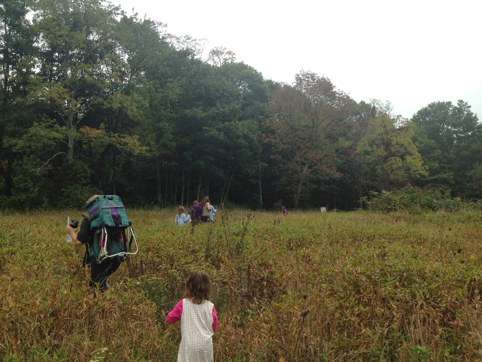 |
| Hiking to look for seeps in the field above Terry's Creek. |
 |
| Another bonus! We experienced an old-growth tree - not too many of these around. |
 |
| After our hike, we got some water samples and tested the water and studied the critters. The pH was 7.0; No turbidity; and great levels of dissolved oxygen. The water was about 50 degrees. |
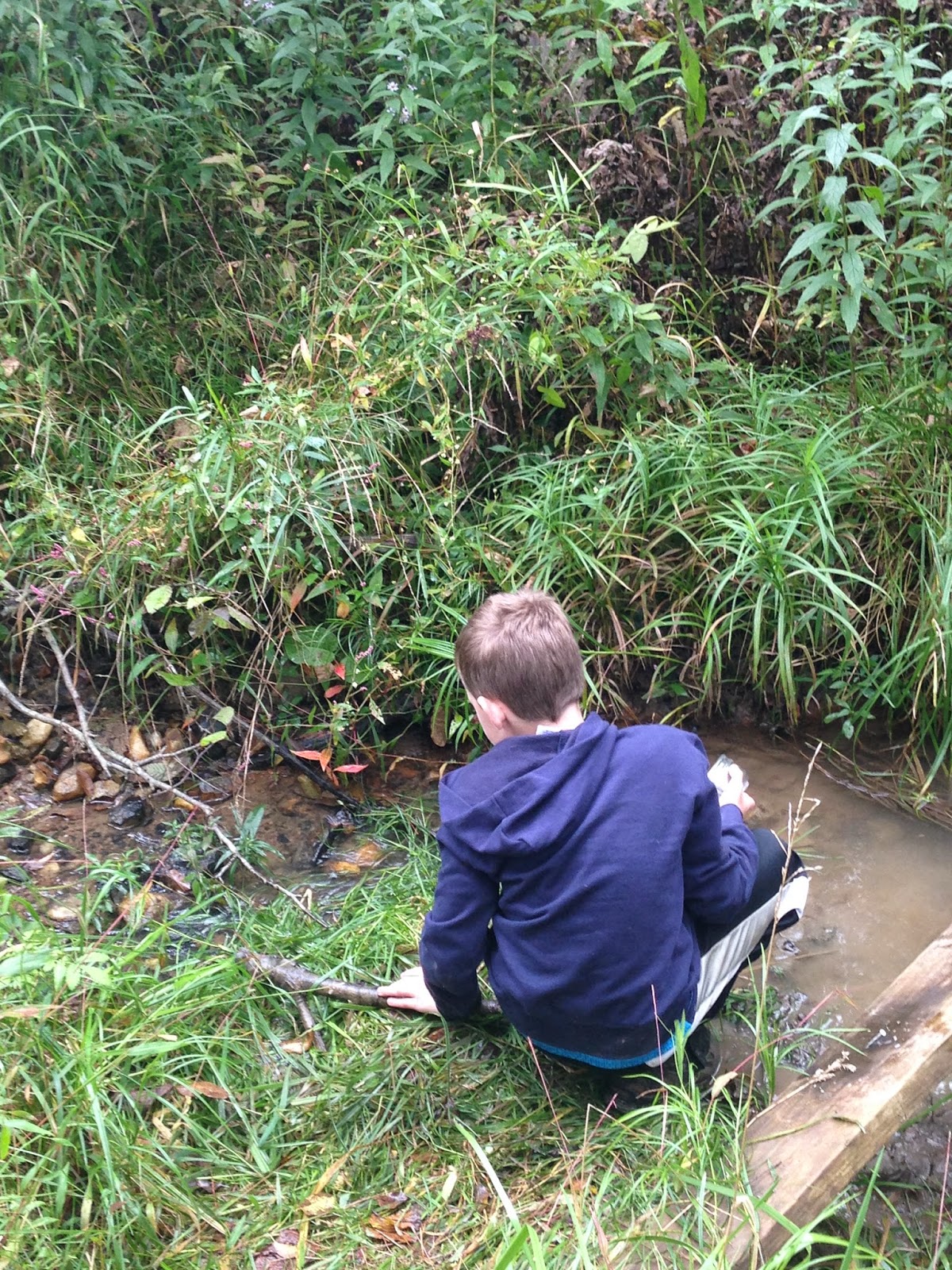 |
| Looking for critters in tributary of Terry's Creek. |
 |
| Macroinvertebrate Identification Key |
Roanoke River Watershed History
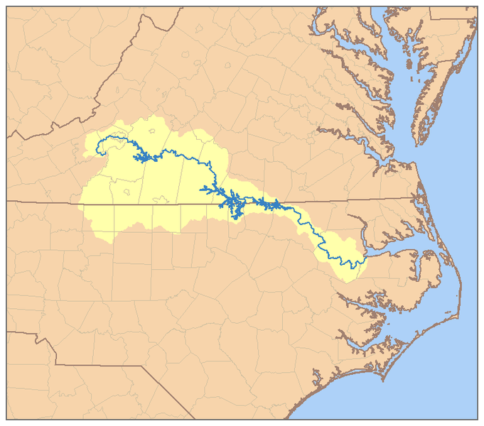 |
| Roanoke River Watershed Map Sourced from: http://en.wikipedia.org/wiki/File:RoanokeRiverWatershed.png
The USGS
Geographic Names Information System includes many historical names that the
Roanoke River has gone by including; Hocomawananch, an Indian name; Roenock by
the European settlers in 1670. It has been labeled as Occaneechi River on Col.
Cadwallader Jones’ map; and named as Staunton River on a 1727 survey map of the
VA-NC state boundary line. The Native Indians and early explorers knew the
infamous river as the “River of Death” due to spring floods that had taken many
lives. The flood plain as it runs through North Carolina spans widths as wide
as 5 miles (NCEE, 2013). After severe flooding in the 1940’s, several dam and reservoir
projects were implemented in the 1950’s-60’s to help control flooding (NCEE,
2013).
The Roanoke River begins at the convergence of the North
Fork Roanoke River and the South Fork Roanoke River within Montgomery County.
The river then flows in a southeast direction through Salem and Roanoke. It is
dammed twice in Virginia, the first time at Smith Mountain Dam, creating Smith
Mountain Lake and again creating Leesville Lake. At the Virginia-North Carolina
border, the Roanoke River is impounded with John H. Kerr dam creating the
expansive Kerr Lake. In North Carolina, Roanoke River is dammed creating Lake
Gaston and also again forming Roanoke Rapids Lake before it flows into the Albemarle
Sound.
Today the Roanoke River provides water to more than one
million people for many uses including drinking water, farm irrigation, fishing
and boating (American Rivers, 2011). It is an economically important resource
drawing thousands of anglers each year, as it “boasts a world-class striped
bass fishery” (American Rivers, 2011). Biologically, the Roanoke River is very
diverse, its soils enhanced from flooding in the bottom portion of the watershed.
The Roanoke River National Wildlife
Refuge is heralded by the Nature Conservancy as “one of the last great
places”; an undisturbed area of expansive forested wetlands along the Roanoke
River fall line to the sound.
Much of this bounty was placed at risk due to threats of uranium
mining in a Roanoke River tributary. The Roanoke River even made American
Rivers Most Endangered Rivers in 2011 due to the potential risk environmental
degradation from uranium ore mining. The mining process leaves radioactive and
contaminated waste that remains for centuries, undermining heath of local watersheds.
Ongoing challenges in the watershed come from population
growth; demand for water is projected to increase by 55% through 2020 (NCEE,
2013)! Stormwater runoff and pollution from agriculture, forestry and construction
are causes of aquatic habitat destruction and impairment. High levels of
dioxin, selenium and mercury have been found in the watershed, creating fish
consumption warnings in the watershed (NCEE, 2013).
American Rivers. 2011. Roanoke River Report. Sourced 10/14/14:
http://www.americanrivers.org/endangered-rivers/2011-report/2011endangered-roanoke/
North Carolina Environmental Education (NCEE). 2013. Roanoke
River Basin. Sourced 10/14/14: http://www.eenorthcarolina.org/images/River%20Basin%20Images/final_web_roanoke.pdf
|
Blog Intent
 |
| Sourced from : http://sifn.bse.vt.edu/sifnwiki/images/thumb/a/a2/Huc_03010101_geographic.png/520px-Huc_03010101_geographic.png |
The purpose of this blog is to convey information that I’ve learned about the Upper Roanoke River Watershed for the Watershed Systems Stewardship class I am taking through VT CLiGS as part of my graduate studies in Natural Resources.
I will be focusing on many subjects throughout the semester.
I wish to concentrate on environmental topics such as invasive and endangered
species, severe erosion sites and wetland sites within the watershed. I will be
exploring land uses and health of the Roanoke River and its tributaries through
data collection of previous testing and personal monitoring. I will be taking a
look at planning efforts and work being undertaken by watershed groups and city
and county governments to meet water quality requirements from point and
non-point pollution sources. I will be investigating green infrastructure
projects around the watershed, as well as rural and urban tree canopy and
riparian buffers.
Occasionally, I will also be posting articles of interest that
are relevant to watershed health, but that may not be specific to the Upper
Roanoke River Watershed.
Thursday, October 2, 2014
Virginia-Manufactured Product Approved by VADEQ for stormwater management
 |
| Picture sourced: http://www.kristar.com/index.php/media-filtration/flogard-perk-filter/38-products/media-filtration/flogard-perk-filter/118-flogard-perk-filter-product-spec |
This new retrofit-style product removes 50% total phosphorus, meeting VADEQ requirements. It has been added to the Virginia Stormwater BMP. Read more about it here.
Subscribe to:
Posts (Atom)